isladogs
MVP / VIP
- Local time
- Today, 18:16
- Joined
- Jan 14, 2017
- Messages
- 18,219
Attached is a fully searchable database of all current UK postcodes.
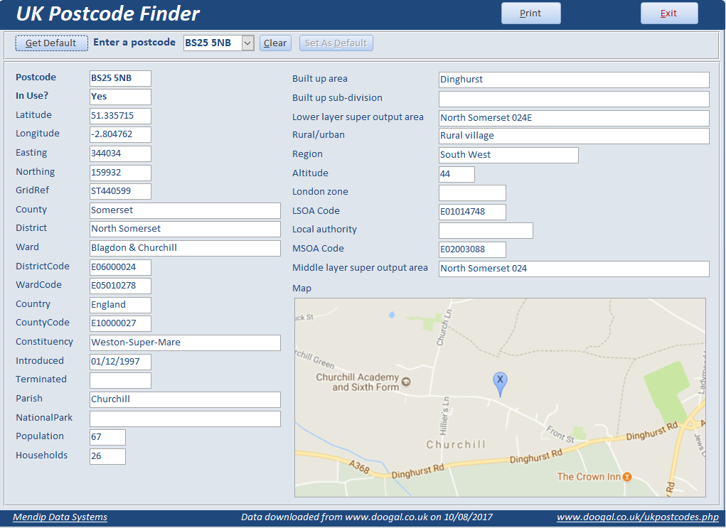
This provides more info than you'll ever need to know about each postcode together with a map of the location (from Google maps)

ONLY the frontend database is attached - save this to a TRUSTED location.
Next download the backend postcode datafile:
There are around 2.5 million UK postcodes so the backend postcode datafile is VERY large.
It is freely available at www.doogal.co.uk and is frequently updated.
You will need to download this datafile yourself (as a zipped MDB file) as it is FAR too big to upload here.
The file size is approx 93 MB zipped & 950 MB unzipped
Unzip the file into the same folder as this frontend.
INSTRUCTIONS:
Hold the SHIFT key down while you open the front end
Relink the table 'Postcodes' to the backend datafile
Close & reopen the frontend normally..
The main form opens automatically
I have used the Google Maps API for this database.
The 'static' postcode map is created instantly (unless your broadband connection is very slow) as an image file Map.bmp in the same folder
I have provided a settings form where you can customise the map created
e.g. map size, zoom level, marker colour etc
For further info, see this link:
https://developers.google.com/maps/documentation/static-maps/intro.
You should obtain your own API key from this site
The API is free up to a limit of 25,000 map loads per 24 hours and with a 640 x 640 maximum image resolution (both should be more than enough here).
Another version of the main searchable postcode form is also provided if you wish to try it.
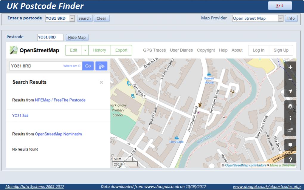
This allows you to view the location on a 'live' map so that you can move around on the map.
Choose from using an internal web browser window or an external browser
In the past, Multimap was excellent for this purpose but it no longer exists.
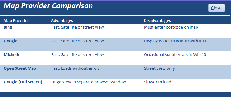
I have tested several options for the live map: Bing / Google / Michelin / Open Street Map with varying results.
Choose the map provider that works best for you
Overall, I found Open Street Map by far the best and its open source software.


NOTE:
To update the data at a later date, just replace the backend database with a new version from the website
UPDATE 13/08/2017
The database expects to find a file called Map.bmp in the same folder.
If its missing you wil get an error message.
Either create a file with that name or download the attached (zipped) example
FURTHER UPDATE: 29/10/2017
The Postcodes MDB file from www.doogal.co.uk has recently been updated and for some reason the field GridRef has been renamed as Grid Ref (with a space). After downloading the file please rename the field removing the space or you will get an error when used with my UKAF db.
Many thanks to Gasman for informing me of this today
This provides more info than you'll ever need to know about each postcode together with a map of the location (from Google maps)
ONLY the frontend database is attached - save this to a TRUSTED location.
Next download the backend postcode datafile:
There are around 2.5 million UK postcodes so the backend postcode datafile is VERY large.
It is freely available at www.doogal.co.uk and is frequently updated.
You will need to download this datafile yourself (as a zipped MDB file) as it is FAR too big to upload here.
The file size is approx 93 MB zipped & 950 MB unzipped
Unzip the file into the same folder as this frontend.
INSTRUCTIONS:
Hold the SHIFT key down while you open the front end
Relink the table 'Postcodes' to the backend datafile
Close & reopen the frontend normally..
The main form opens automatically
I have used the Google Maps API for this database.
The 'static' postcode map is created instantly (unless your broadband connection is very slow) as an image file Map.bmp in the same folder
I have provided a settings form where you can customise the map created
e.g. map size, zoom level, marker colour etc
For further info, see this link:
https://developers.google.com/maps/documentation/static-maps/intro.
You should obtain your own API key from this site
The API is free up to a limit of 25,000 map loads per 24 hours and with a 640 x 640 maximum image resolution (both should be more than enough here).
Another version of the main searchable postcode form is also provided if you wish to try it.
This allows you to view the location on a 'live' map so that you can move around on the map.
Choose from using an internal web browser window or an external browser
In the past, Multimap was excellent for this purpose but it no longer exists.
I have tested several options for the live map: Bing / Google / Michelin / Open Street Map with varying results.
Choose the map provider that works best for you
Overall, I found Open Street Map by far the best and its open source software.
NOTE:
To update the data at a later date, just replace the backend database with a new version from the website
UPDATE 13/08/2017
The database expects to find a file called Map.bmp in the same folder.
If its missing you wil get an error message.
Either create a file with that name or download the attached (zipped) example
FURTHER UPDATE: 29/10/2017
The Postcodes MDB file from www.doogal.co.uk has recently been updated and for some reason the field GridRef has been renamed as Grid Ref (with a space). After downloading the file please rename the field removing the space or you will get an error when used with my UKAF db.
Many thanks to Gasman for informing me of this today
Attachments
Last edited:


